The next generation EFB weather and optimization tool
10 KM RESOLUTION WEATHER
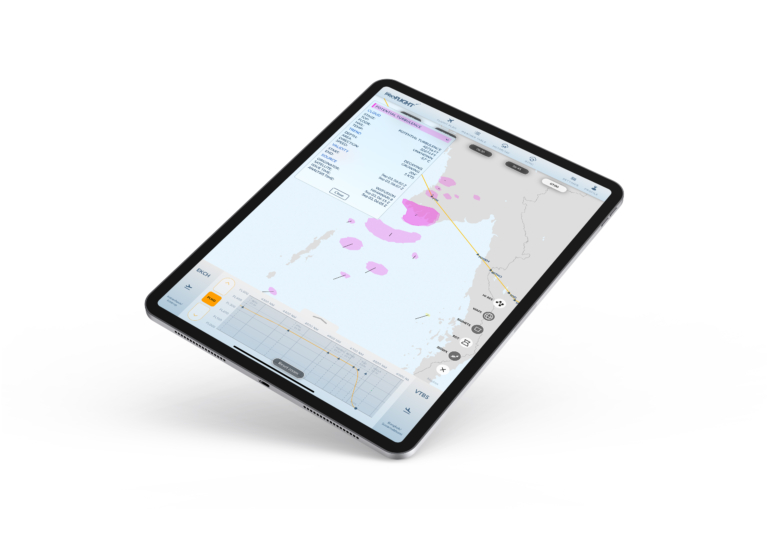
REAL-TIME CB-SATELLITE DATA
FLIGHT PROFILE OPTIMIZATION
Previous
Next
Designed by pilots for pilots
Combining AVTECH’s Aventus premium services NOWCAST and SIGMA (powered by Met Offices´s 10KM resolution weather forecast), results in a unique decision support tool. This tool provides tailored weather information and flight path optimization ensuring a safer flight for both passengers and crew while saving fuel, cut emissions and increase cost savings.
Real-time Satellite Data
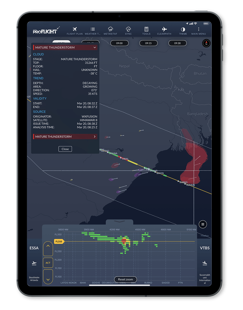
Avoid thunderstorms with real-time satellite-based CB cloud detection from WxFusion. Visualized for pilots inside ProFlight. Get to where you are going, safer and more efficient.
Features
High resolution CAT and winds
Airport METARs and TAFs
WAFS CAT and ICE
Flight profile optimization
Real-time CB Layer
Interactive SIGMETs and SWC
Flight plan search
Easy to use
Minimum data transfer
High Resolution Weather Access
The Met Office, UK’s National weather service, is one of only two World Area Forecast Centres (WAFC) providing global high-level weather information.
Through a jointly developed API, to which AVTECH has an exclusive access, tailored 10KM High-Resoultion weather is retrieved for each individual flight.
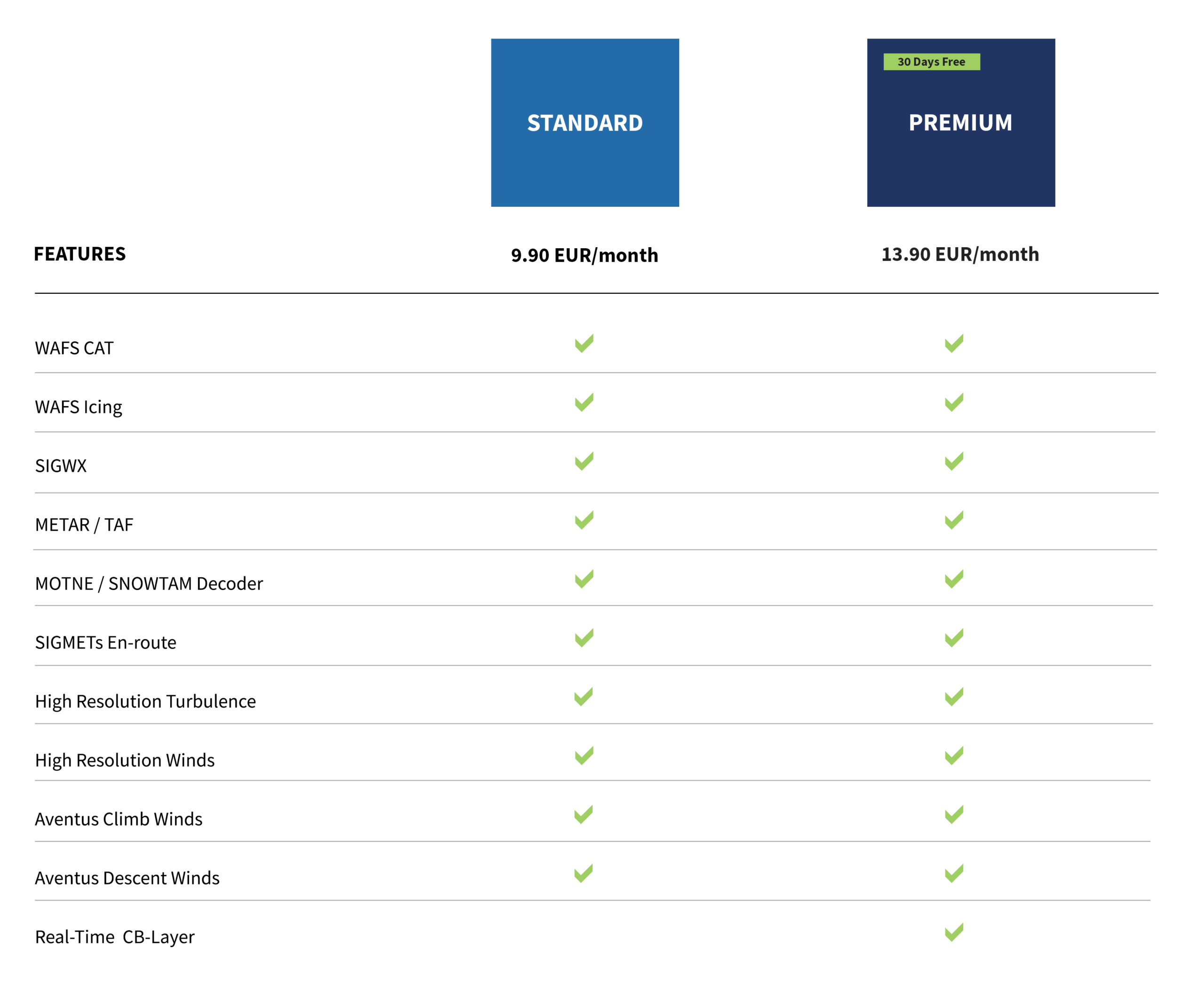
Subscriptions / Plans
Try it yourself
Sign up for a free trial and get PREMIUM access to AVTECH ProFlight. Search and activate your flight by callsign and receive flight profile optimization and high-resolution weather information.
Vi använder cookies för att se till att vi ger dig den bästa upplevelsen på vår webbplats. Om du fortsätter att använda denna webbplats kommer vi att anta att du godkänner detta.