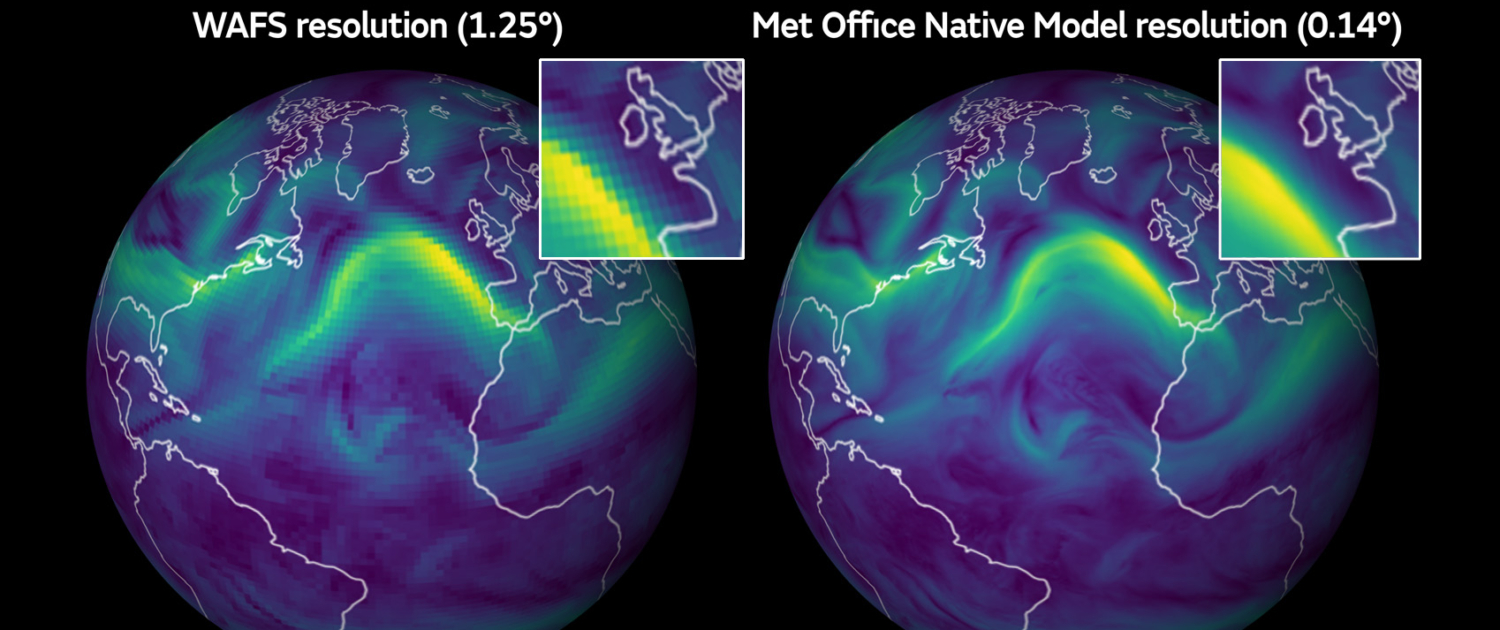
What is the difference between WAFS weather and high-resolution forecasts and how do the Met Office UK and AVTECH co-operate?
Weather data is used in flight planning to optimize the timing, efficiency and safety of a flight and the more accurate the weather data, the greater the efficiencies for the airline. The UK Met Office provides high-resolution weather data derived from its global model to all of AVTECH’s products to reduce the amount of errors between what has been forecast and what is actually happening along an aircraft’s planned flight path.
The current World Area Forecast System (WAFS) dataset provided by the Met Office and NOAA, is required by ICAO, to have a resolution of 1.25 degrees, which is approximately 9 minutes of flying time between each wind forecast point. However, the base data generated at the UK Met Office is at a resolution of 0.14 degrees, which is downscaled for WAFS. This base data reduces flying time to under a minute between each wind forecast point.
With high-resolution weather data the amount of errors between what has been forecast and what is happening is reduced, ultimately building up a much clearer picture of the weather along an aircraft’s planned flight path.
The Met Office provides 4D trajectory data on demand via an API so that AVTECH can make requests in real-time for data from the Met Office’s global model. This can be used for the descent, cruise and climb phases of operation for any global airport. The 4D trajectory query can also extract a “corridor” of weather forecast data from the weather model to identify gridded aviation hazard data, e.g. turbulence into the AVTECH proFLIGHT product range as well as winds for Aventus.
Have you tried the 10K high-resolution aviation forecasts? You can do it for free in our proFLIGHT app. Link to sign up: https://proflight.avtech.aero


